Thor Delta
In-activeMcDonnell Douglas (MDC)
May 13, 1960
Description
American orbital launch vehicle. Commercial name for the military's Thor-Delta.
Specifications
-
Stages
3 -
Length
31.0 m -
Diameter
2.44 m -
Fairing Diameter
2.44 m -
Launch Mass
54.0 T -
Thrust
667.0 kN
Family
-
Name
Thor Delta -
Family
― -
Variant
Delta -
Alias
― -
Full Name
Thor Delta
Payload Capacity
-
Launch Cost
$7270000 -
Low Earth Orbit
226.0 kg -
Geostationary Transfer
Orbit
― -
Direct Geostationary
― -
Sun-Synchronous Capacity
―
McDonnell Douglas
Commercial
None
MDCNone
Thor Delta | Tiros 6
McDonnell Douglas | United States of AmericaCape Canaveral SFS, FL, USA
Sept. 18, 1962, 8:53 a.m.
Thor Delta | Telstar 1
McDonnell Douglas | United States of AmericaCape Canaveral SFS, FL, USA
July 10, 1962, 8:35 a.m.
Thor Delta | Tiros 5
McDonnell Douglas | United States of AmericaCape Canaveral SFS, FL, USA
June 19, 1962, 12:19 p.m.
Thor Delta | Ariel 1
McDonnell Douglas | United States of AmericaCape Canaveral SFS, FL, USA
April 26, 1962, 6 p.m.
Thor Delta | OSO 1
McDonnell Douglas | United States of AmericaCape Canaveral SFS, FL, USA
March 7, 1962, 4:06 p.m.
Thor Delta | Tiros 4
McDonnell Douglas | United States of AmericaCape Canaveral SFS, FL, USA
Feb. 8, 1962, 12:43 p.m.
Thor Delta | Tiros 2
McDonnell Douglas | United States of AmericaCape Canaveral SFS, FL, USA
Nov. 23, 1960, 11:13 a.m.
Thor Delta | Echo 1
McDonnell Douglas | United States of AmericaCape Canaveral SFS, FL, USA
Aug. 12, 1960, 9:39 a.m.
Status: Launch Successful
Mission:
The Echo 1A spacecraft was a 30.48 m diameter balloon of mylar polyester film 0.0127 mm thick. The spacecraft was designed as a passive communications reflector for transcontinental and intercontinental telephone (voice), radio, and television signals. It had 107.9 MHz beacon transmitters for telemetry purposes. These transmitters were powered by five nickel-cadmium batteries that were charged by 70 solar cells mounted on the balloon. Because of the large area-to-mass ratio of the spacecraft, data for the calculation of atmospheric density and solar pressure could be acquired. The spacecraft was also used to evaluate the technical feasibility of satellite triangulation during the latter portion of its life. Echo 1 failed during the coast period after launch, as the attitude control jets on the second stage failed and the spacecraft did not achieve orbit. Echo 1A was a successful relaunch.
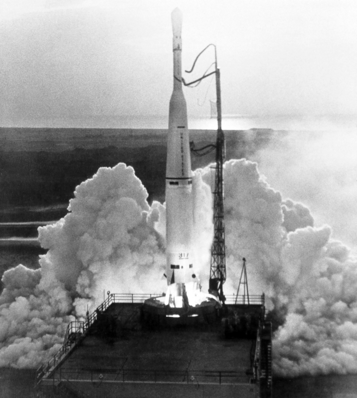
Elliptical OrbitThor Delta | Echo
McDonnell Douglas | United States of AmericaCape Canaveral SFS, FL, USA
May 13, 1960, 9:16 a.m.
Status: Launch Failure
Mission:
The Echo 1 spacecraft was a 30.48 m diameter balloon of mylar polyester film 0.0127 mm thick. The spacecraft was designed as a passive communications reflector for transcontinental and intercontinental telephone (voice), radio, and television signals. It had 107.9 MHz beacon transmitters for telemetry purposes. These transmitters were powered by five nickel-cadmium batteries that were charged by 70 solar cells mounted on the balloon. Because of the large area-to-mass ratio of the spacecraft, data for the calculation of atmospheric density and solar pressure could be acquired. The spacecraft was also used to evaluate the technical feasibility of satellite triangulation during the latter portion of its life. Echo 1 failed during the coast period after launch, as the attitude control jets on the second stage failed and the spacecraft did not achieve orbit. Echo 1A was a successful relaunch.
Elliptical OrbitFalcon 9
Starlink Group 17-35
Space Launch Complex 4E - Vandenberg SFB, CA, USAA batch of 25 satellites for the Starlink mega-constellation - SpaceX's project for space-based Internet communication system.
Atlas V 551
Amazon Leo (LA-05)
Space Launch Complex 41 - Cape Canaveral SFS, FL, USAAmazon Leo, formerly known as Project Kuiper, is a mega constellation of satellites in Low Earth Orbit that will offer broadband internet access, thi…
Soyuz 2.1a/Fregat-M
Meridian-M No.21L
43/3 (43L) - Plesetsk Cosmodrome, Russian FederationNote: Payload identity uncertain. Meridian is a series of communications satellite for military and civilian use.
Tianlong-3
Demo Flight
Tianlong-3 Launch Pad - Jiuquan Satellite Launch Center, People's Republic of ChinaFirst test launch of Space Pioneer’s Tianlong-3 rocket.
Falcon 9
Starlink Group 10-58
Space Launch Complex 40 - Cape Canaveral SFS, FL, USAA batch of 29 satellites for the Starlink mega-constellation - SpaceX's project for space-based Internet communication system.

